In 2021, Council formulated the A2040 Community Strategic Plan - Alexandrina’s 20-year strategic vision and in doing so put our future in the hands of the community. What we heard was a desire for our region to thrive as a Liveable, Green and Connected place for all to enjoy.
Alexandrina Council continues to grow, with the population projected to increase significantly by 2040. Our communities are also experiencing the impacts of climate change, including reduced rainfall, warming, extremes of weather and natural disasters, such as bushfires and flooding. Forward-thinking planning and urban design strategies will be critical to ensure that, despite increased urbanisation, we are able to protect existing natural areas and allow for their extent to increase.
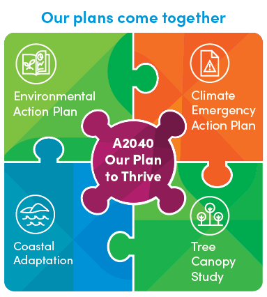
Because of the challenges Alexandrina Council faces, Council developed several key strategic documents to manage our environment, coast and climate change.
The Environmental Action Plan 2030 expresses Council’s commitment and articulates that we will be worthy stewards of the land and waters of our Council area. This Plan sets the context, the opportunities, and challenges for making the changes needed to protect our ecosystems, and to manage and enhance our three main themes: Biodiversity, Waters, and Communities.
The Climate Emergency Action Plan on the other hand is our key strategic document to reduce Council and community emissions within Alexandrina. The draft Climate Emergency Action Plan outlines how we all (Council and community) can play a part in reducing emissions. Council will act as a role model for the community by making its own commitments and facilitating change in our community.
The Climate Change Policy is Council’s key policy to embed consistent and robust approach into all Council decision-making and activities, and signals commitment to our community to lead by example.
The Carbon Neutral Plan sets out goals, actions, and targets, and provides an independent, evidence-based roadmap to guide Council towards carbon neutrality by 2040.
The Tree Canopy Report provides and overview of the tree canopy baseline for 11 townships, the ‘heat island’ effect across these townships (‘heat maps’), and the canopy cover by landholder. To find out more about what's be done in this space, visit the Tree Canopy Study page.
The Coastal Adaptation Study studies the historical shoreline movements of our coastline, followed by an assessment of risks and vulnerabilities of our coast to projected sea level rise impacts across our coastline. To find out more about what's be done in this space, visit the Coastal Adaptation page.
The Coastal Adaptation Plan provides a roadmap for Council, identifying priority works along our coastline for the immediate, intermediate, and longer term. To find out more about what's be done in this space, visit the Coastal Adaptation page.
The infographic below highlights how these strategic areas align.